
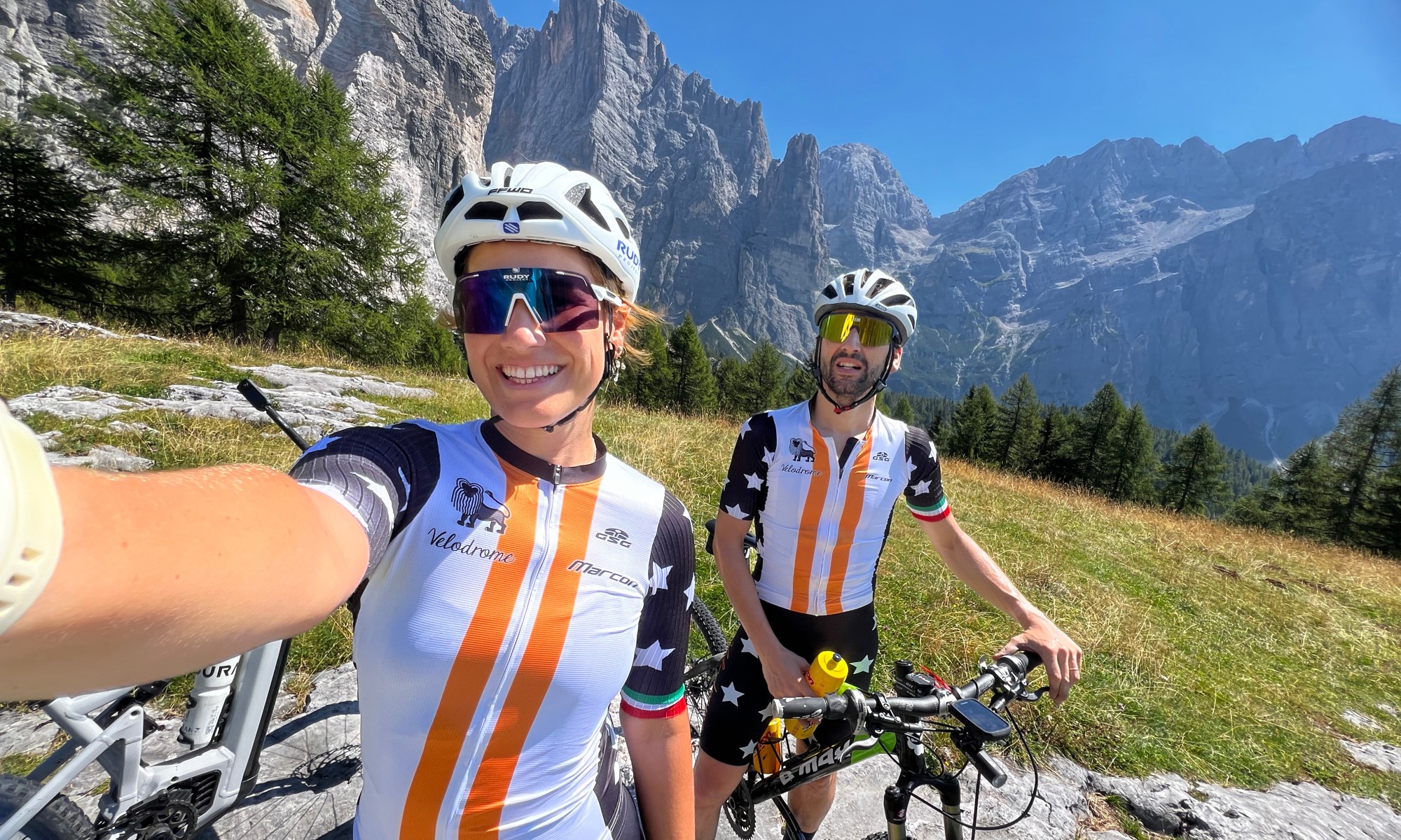
Rifugio Vazzoler is one of those places in the Dolomites that seems made for reaching by bike. Or maybe not: once you look at the climb from the saddle, you might change your mind pretty quickly.
My brother and I started from Alleghe and rode to Listolade, where the route into Val Corpassa begins. From there we climbed to Rifugio Vazzoler and then continued towards Malga Pelsa. I was riding an e-MTB. My brother wasn’t. And that difference became quite important on the way up.
ROUTE DATA
📍 Start: Listolade – 691 m
🏔️ Finish: Malga Pelsa – 1,836 m
🚵 Bike: e-MTB
📏 Distance to Malga Pelsa: 10 km
⬆️ Elevation gain between start and highest point: 1,145 m
⛰️ Maximum elevation: 1,836 m
⏱️ Listolade → Rifugio Vazzoler: approx. 1 h 20 min
⏱️ Vazzoler → Malga Pelsa: approx. 25 min
⏱️ Malga Pelsa → Listolade: approx. 35 min
🔄 Return: same route
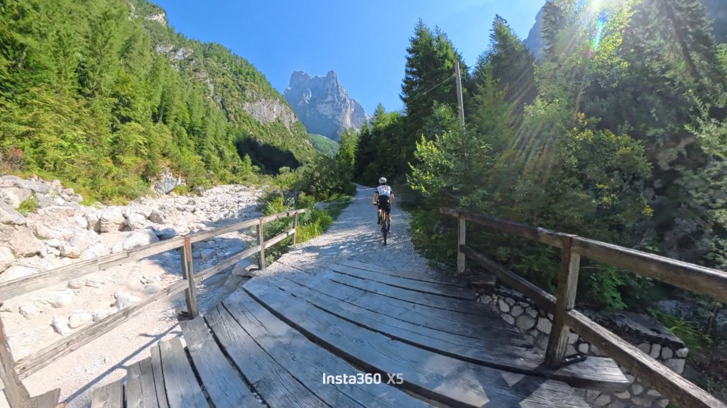
The road 555 towards Rifugio Vazzoler, with the Dolomites in the background.
From Listolade into Val Corpassa
The route starts in Listolade, just after Agordo, and follows the road into Val Corpassa towards Rifugio Capanna Trieste.
This first section is quite different from what comes afterwards: the road is paved and climbs through the valley alongside the Corpassa stream. Capanna Trieste sits at around 1,135 metres and is where the paved road ends and the gravel section towards Vazzoler begins.
This is where route 555 starts, climbing through Val Corpassa towards the Mussaia and Pian delle Taie areas. The route is essentially a forest road with a fairly steady gradient, first through the woods and then progressively closer to the huge rock faces of the Civetta group.

The first part of the climb through Val Corpassa.
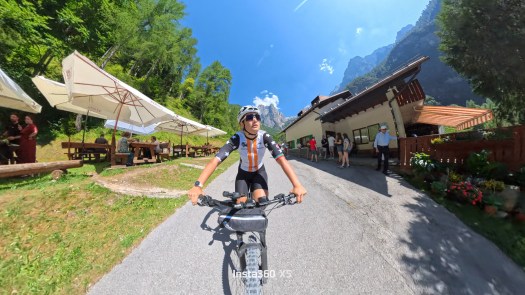
Capanna Trieste, at around 1,135 metres, where the paved road ends and the gravel section begins.
Route 555 towards Rifugio Vazzoler
From Capanna Trieste, the character of the road changes completely. You move onto the gravel and dirt road of route 555, climbing towards Vazzoler. The distance from Listolade to the refuge is around 8 km, while from the Capanna Trieste parking area there are roughly 4–4.5 km and around 600 metres of elevation gain remaining.
The route passes through the Mussaia area and reaches Pian delle Taie, at the foot of Torre Trieste. From here the landscape changes quickly: the rock faces become increasingly close and Torre Trieste dominates almost the entire climb. And this is where I started having doubts.

The more demanding section of the climb, with loose gravel and the huge Civetta walls in the background.
The road itself isn’t technically difficult in the way a proper MTB trail can be. The main challenge is the surface. In several sections, the gravel is deep and loose and, when the gradient increases, finding traction and keeping a clean line becomes harder.
Descriptions of the route put the section from Capanna Trieste to Vazzoler at around 600 metres of elevation gain over just over 4 km; one MTB-specific description also points out the significant gradients in the hardest sections.
My experience was a little different from what I expected. I wouldn’t call it a route for complete beginners, especially because of the surface and some of the steeper sections. But I also wouldn’t say you need expert MTB skills.
You mainly need to be comfortable handling a bike on loose ground. And in my case, having a motor helped quite a lot.
Reaching Rifugio Vazzoler
After around 8 km from Listolade and about an hour and twenty minutes of climbing, we reached Rifugio Vazzoler at 1,714 metres.
The refuge sits on Col Negro di Pelsa, in a spectacular position between Torre Venezia and Torre Trieste, at the entrance to Val dei Cantoni.
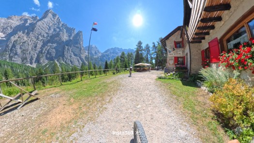
Rifugio Vazzoler, at 1,714 metres.
This would have been a perfectly reasonable place to stop. We decided to keep going. Because once we’d made it that far, we might as well see where the road went.
From Vazzoler towards Malga Pelsa
From the refuge, the route continues along a dirt road towards the Malghe di Pelsa.
The route described by the refuge is around 2 km with 150 metres of elevation gain and a relatively gradual climb. For us, this section became more interesting because the surface changes.
The gravel road gives way to more proper dirt sections, and you also reach the unstable area at the base of Torre Venezia.

The road after Vazzoler, heading towards the Pelsa area.
About 25 minutes after leaving Vazzoler, we reached the Malga Pelsa area, our highest point of the ride at 1,836 metres. This was probably the most spectacular part of the whole climb.
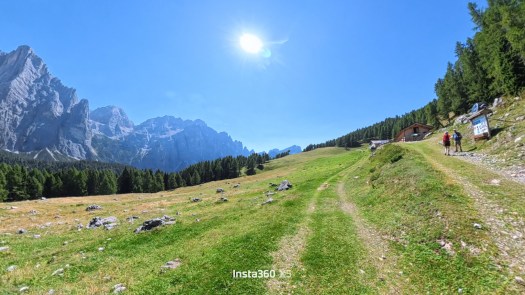
The Malga Pelsa area, at around 1,836 metres.
The short section under Torre Venezia
There is one section here that deserves a specific mention. At the base of Torre Venezia, the surface changes completely. You come across a section of loose rock and unstable ground. The route descriptions also mention this landslide area at the base of Torre Venezia before the route continues towards Pelsa.
For us, this was the one section where it simply didn’t make sense to stay on the bikes. It’s only around 50 metres, so we’re not talking about a long impassable section. But with that kind of surface, we decided to get off and walk.
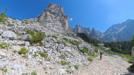
Torre Venezia seen from the route.
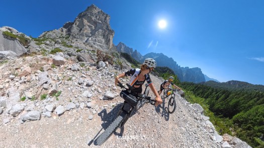
The short rocky and unstable section under Torre Venezia.
I walked it on the way up, and I walked it again on the way back. My brother, on the other hand, decided he could ride it. And honestly, looking back at it afterwards, I think I probably could have ridden it too. But it had been a long time since I’d properly ridden off-road, and I still didn’t feel completely comfortable on a mountain bike.
At that moment, I simply didn’t trust myself enough to force it.
But what is the descent really like?
This is where things got interesting. During the climb, I had been looking at the surface the whole time. Deep gravel. Rocks. Steep sections. And while climbing, I kept thinking:
Okay, but I’m going to have to ride back down this.
Okay, but I’m going to have to ride back down this.
I was convinced the descent would be the difficult part. It wasn’t. Once we started descending, everything that had made me doubt myself on the way up suddenly seemed much more manageable. The surface was easier to read, the bike rolled well and, most importantly, the descent was over much faster than I expected.
It took us around 35 minutes from Malga Pelsa back to Listolade. By that point I realised that maybe the biggest problem wasn’t the route. It was my confidence.
The full MTB descent
I had mounted an Insta360 X5 specifically because I wanted to record the descent. This time I decided to leave the video almost exactly as it happened: no aggressive editing, no constant cuts. Just the complete descent from my point of view.
The front-facing view fills the screen, while a small inset shows me riding. Speed, distance, elevation and gradient data are also visible throughout the video. So if you want to get a real idea of what the road looks and feels like on the way down, just press play.
The complete descent recorded with the Insta360 X5.
Looking back at it now, what makes me smile is how different my perception was before we started.
On the way up, I thought the surface was going to be a problem. On the way down, I realised that the biggest problem was probably the lack of confidence I had in myself and in the bike.
Would I do it again?
Yes. Not because I’ve suddenly become a mountain biker. And not because I’ve discovered that I’m particularly good at descending. That’s not it. It was simply because it had been too long since I’d stepped outside my usual comfort zone on a bike. I’m used to road and track cycling. I’m used to thinking of the bike as a tool for training, racing, improving a number or preparing for something. This time, there was none of that.
My brother and I simply went into the mountains. We rode, he suffered quite a lot on the climb while I at least had the advantage of the motor, we walked a short section, stopped to look at the mountains and then headed back down. And in the end, the descent that had made me nervous throughout the entire climb was probably the most fun part.
Maybe next time I’ll trust myself a little more.
As for the route, though, there’s one thing I’d say clearly: it’s not the technical difficulty that makes it challenging, but the combination of gradient and loose, unstable ground.
And if you decide to ride it, make sure to check the current access rules and conditions before your ride, as the current sources don’t describe bicycle access to this section in exactly the same way.
Other than that, be ready for something very simple: a climb that feels like it never ends, and a descent that, once it starts, is over much sooner than you’d like.


One Reply to “”